
Guide to Hiking in Interlaken: 8 Incredible Trails for Every Fitness Level
Disclaimer: Some of the links in this blog post are affiliate links. I may earn a commission if you click on the link or make a. purchase using the link at no cost to you. Review the full disclaimer here.
I’ve had Switzerland on my travel list forever, and hiking in Interlaken was at the top of it.
The photos alone were enough to get me hooked, and I wanted to see the views with my own eyes.
The first hike I did was Stoos Ridge. I stopped here on my way to my hotel in Interlaken from Zurich on my first day in Switzerland.
I kicked off my trip with fresh air, mountain views, and the sound of cow bells in the distance. I stopped thinking about work or home and just let myself be fully in vacation mode.
I spent six days in Interlaken and fit in four hikes in this region.
Honestly, I could’ve done nothing else and still left feeling like I experienced the best of Switzerland.
Regardless of your fitness level, hiking in Interlaken gives you access to some of the most beautiful trails in the Alps.
In this post, I’m breaking down the eight best hikes in and around Interlaken—from the trails that left me speechless to the ones I missed (and seriously regret).
Let’s hit the trail.
Which Interlaken Hike Is Right for You? (Quick Guide!)
There are a ton of hiking options in and around Interlaken, and it can be hard to figure out which ones are worth it especially if you’ve only got a few days and you’re trying to fit a lot into your Switzerland Itinerary.
These are the trails I either did myself or had saved on my list after way too much research (plus some local tips).
If you’re short on time, here’s where I’d start:
➡ Best sunrise hike: Augstmatthorn via Lombachalp
➡ Most scenic hike: Oeschinensee Panorama Trail
➡ Best ridge walk: Stoos Ridge Hike
➡ Easiest with amazing views: Stechelberg to Lauterbrunnen
➡ Most challenging hike: Morgenberghorn
➡ Overnight mountain hut hike: Stechelberg – Obersteinberg – Oberhornsee – Schmadrihütte Loop
➡ Best short hike: Spielbodenalp via Mürren
➡ Best hike with flexibility (train + trail): Brienzer Rothorn
Now, let’s break them down in detail.
Why Interlaken is the Best Homebase for Hiking
When I traveled to Switzerland, I opted to stay in Interlaken because it’s close to many towns I wanted to visit such as Grindelwald, Lauterbrunnen, and Lucerne, which all had great hiking.
Even if you don’t stay in Interlaken for your entire trip, it’s a good starting point for many towns and hikes that are likely on your list.
If you plan on using public transportation, you can easily get to trailheads outside of Interlaken via train and gondola.
You don’t need to rent a car for hiking in Switzerland; a Swiss Travel Pass will get you to most locations, but there are some trails that we’ll cover in this post that do require a car to get to the trailhead.

⭐️⭐️⭐️⭐️⭐️
Swiss Travel Pass
✨ Unlimited travel by train, bus, boat, and public transportation
✨ Discounts on activities
✨ Free entry to many museums
The Best Hiking Trails in Interlaken (Ranked by Difficulty)
1. Augstmatthorn via Harder Kulm (+ a shortcut)
The Augstmatthorn hike was my favorite and most challenging one I did while I was in Switzerland. Honestly, maybe ever.
While challenging, it’s very rewarding. This hike will give you some of the best views of both Lake Brienz and Lake Thun.
You’ll walk along the ridgeline and have amazing views the whole way.
You have two options for completing this hike.
Option 1: Augstmatthorn Via Harder Kulm
Hiking stats: 17.7km (11mi) | 6.5 hrs | Hard | Save this trail
After taking the funicular up to Harder Kulm, you’ll begin your hike. It’s a challenging trail with some steep climbs, but doable for most fitness levels.
On a clear day, you can see the Eiger, Mönch, and Jungfrau.
Plan on giving yourself 6 to 9 hours, depending on your pace and how many snack breaks you take.
Option 2: Augstmatthorn – Suggiture via Lombachalp
Hiking stats: 6.4km (4mi) | 3.5 hrs | Hard | Save this trail
The shortcut is 4 miles long and is more challenging because you are gaining 1,873ft of elevation in just 2 miles.
I’m a casual hiker, and while I found this hike very difficult, it’s doable if you are looking for a challenge.
This hike took me about 3.5 hours to complete.
Keep in mind that you are scaling rocks at one point, and it can get muddy.
I opted for the shortcut so I still had my afternoon open, which I spent paddle boarding in Lake Brienz, soaking my sore limbs in the cool water.

2. Brienzer Rothorn
Hiking stats: 18.8km (11.7mi) | 9 hrs | Advanced | Save this trail
This hike starts near Schwanden bei Brienz, Bern and takes you up to Brienzer Rothorn where you’ll see some of the best views of Lake Brienz and the surrounding Jungfrau region.
The full loop trail is 18.8 km (11.7 miles) and usually takes about 9 hours. It’s a challenging route with steep climbs, rocky sections, and a serious workout
If the full hike sounds daunting and isn’t for you, you have options!
The Brienzer Rothorn train journey is a historic steam-powered cogwheel train that can take you up and/or down.
You can ride the train to the summit at Rothorn Kulm, walk along the ridgeline for a bit, and then take the train back down.
Make sure to check the train times before you head out. The weather can change fast at this height, so pack layers and keep an eye on the forecast.

3. Morgenberghorn via Pochtenfall
Hiking stats: 10.3km (6.4mi) | 6 hrs | Hard | Save this trail
The Morgenberghorn loop hike starts near Aeschi bei Spiez, Bern. It will take you through forest trails, alpine terrain, and open meadows.
You’ll pass Pochtenfall, a waterfall along the trail. From there, the trail gets steeper and more exposed as you gain elevation toward the summit.
The last stretch to the summit is very steep and includes some chain-assisted sections.
You’ll need steady footing, especially if the rocks are damp. That said, the payoff at the top is pretty incredible.
On a clear day, you’ll get views over both Lake Thun and Lake Brienz, with the Eiger, Mönch, and Jungfrau in the distance.
It’s challenging, but if you’re an experienced hike and up for a good climb, it’s a beautiful and rewarding route.
Dogs are allowed and can be off-leash in some areas, but the steeper sections might be tricky for them.
The best months for this hike are May through October when conditions are more stable and the trail is clear of snow.
4. Stechelberg – Obersteinberg – Oberhornsee – Schmadrihütte Loop
Hiking stats: 18.3 km (11.4 miles) | Hard | Save this trail
This hike starts at the large parking area in Stechelberg, in Lauterbrunnen Valley. One of the first big stops is the Tschingelhorn Mountain Inn, where you can grab some lunch.
From there, the trail becomes more exposed as you continue hike toward Obersteinberg.
On this hike, you’ll also pass Oberhornsee, the popular glacial lake that’s worth the detour if you don’t plan on hiking there on a separate day.
Then you’ll finally reach Schmadrihütte, which has a very simple shelter with 8 beds.
If you’re planning to stay overnight here, make sure to book in advance; spots are very limited.
The trail is in it’s best conditions late spring through early fall (May to October), though even in summer you may encounter snow above 2,000 meters.
This is a challenging hike and not for beginners.
5. Stoos Ridge Hike
Hiking stats: 4.35km (2.7mi) | 2 hrs | Moderate | Save this trail
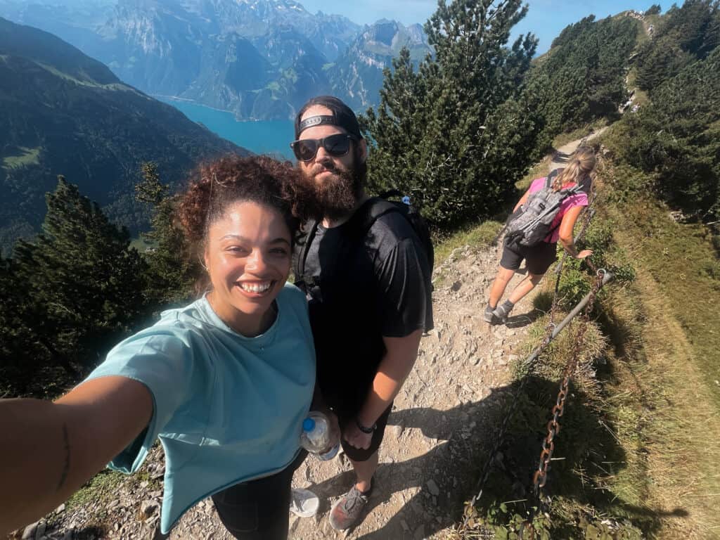
Stoos Ridge is one of the most popular ridge walks in central Switzerland, located in between Zurich and Interlaken.
I stopped to do this hike on my way to Interlaken and was so glad I did. It took just a couple hours and it was a great way to stretch my legs before continuing the drive.
To get there, you’ll head to the Stoosbahn base station in Schwyz, where there’s plenty of parking available.
From there, take the funicular up to the village of Stoos. Once at the top, you’ll take a chairlift to Klingenstock, which is where the hike begins.
The trail follows a narrow ridgeline for just under 5 km, finishing at Fronalpstock. The last hill at the end of the hike is quite steep, but most people with a decent fitness level can handle it.
Once you reach Fronalpstock, you can take the chairlift back down to Stoos, where you’ll hop on the funicular to return to your car.
This hike is quite touristy. There were a lot of people on the trail when I was there but it never felt like it was overcrowded or like I was slowed down.
If you’ve got time after the hike, Lucerne makes a perfect lunch stop where you can walk the Chapel Bridge, grab something to eat by the lake.
6. Spielbodenalp via Mürren
Hiking stats: 6km (3.7mi) | 2 hrs | Moderate | Save this trail
This is a great short hike if you’re taking a day trip through the Lauterbrunnen area and want something scenic that won’t take all day.
The out-and-back route to Spielbodenalp is about 6 km (3.7 miles) roundtrip, with a steady incline and views of the Eiger, Mönch, and Jungfrau the entire way.
Most hikers finish it in under two hours.
To get there, you’ll need to make your way to Mürren, a car-free village above the Lauterbrunnen Valley.
First, drive or take the train to Lauterbrunnen, then from the Lauterbrunnen cable car station get on a gondola to the Grütschalp cable car station.
From there, you’ll hop on the mountain train to Mürren.
Once in Mürren, the trail is easy to follow. It climbs gently through pastures and pine forest, with plenty of photo-worthy spots along the way.

7. Oeschinensee Panorama Trail
Hiking stats: 3.7km (2.3mi) | 1.5 hrs | Moderate | Save this trail
Oeschinensee was high on my list, but we ran out of time and didn’t make it—definitely one of my biggest trip regrets.
We hiked a bunch of other trails nearby, but this one kept coming up as a must-see, and I can see why.
The lake is known for its turquoise color, dramatic cliffs, and a handful of trails that offer views from all angles.
You can take the cable car from Kandersteg and do an easy walk to the lake, or take one of the longer, more challenging routes for even more epic views.
8. Stechelberg To Lauterbrunnen
Hiking stats: 6.4km (4 mile) | Easy | 2 hrs one-way | Save this trail
This flat 4 mile stroll through the Lauterbrunnen Valley was one of my favorites.
You’ll pass by some of the valley’s famous 72 waterfalls as you stroll from the Stechelberg station to Lauterbrunnen village.
It’s perfect if you want a break from challenging hikes or are with little kids. The path is paved and flat the entire way.
I would plan ahead for this hike. You probably wouldn’t find it without planning it ahead of time.
I planned this as part of my day trip to Lauterbrunnen and Mürren.
When you arrive in Lauterbrunnen, take the cable car up to Grütschalp. From Grütschalp, you’ll hop on the train to Mürren.
Spend some time in Mürren and grab some lunch.
Once you’re done, head to the Mürren to Stechelberg Station at the opposite end of the village.
When you arrive at the Stechelberg Station, you’ll exit into a parking lot where you’ll see the trailhead to begin your stroll from Stechelberg to Lauterbrunnen.

Do You Need a Swiss Travel Pass for Hiking in Interlaken?
Quick answer?
YES, IF: you don’t have a car: The Bernese Oberland Pass is worth it for free mountain transport.
NO IF: If you rented a car: A travel pass may not be any cheaper for just for discounted gondolas.
Swiss Travel Pass vs. Renting a Car – Which is Better?
Switzerland’s public transport is very efficient and easy to use, but having a car gives you full control over your trip.
Here’s how to choose what’s best for you:
Renting a Car
- Good for: Remote areas, spontaneous stops, packing without worrying about luggage
- Best if: You like driving and want to go at your own pace
- Things to Consider:
- Don’t buy a travel pass if you have a car. Any gondola or train ticket you buy will still be cheaper than getting a pass in addition to the rental car.
- ✨ Book Your rental car ✨
Swiss Travel Pass
- Good for: Trains, buses, boats + discounts on gondolas and mountain transportation
- Best if: You don’t plan on renting a car
- Options:
- Swiss Travel Pass – Covers all public transport (3-15 days)
- Berner Oberland Pass – Best for Interlaken & the Jungfrau region
- Swiss Half Fare Card – 50% off tickets. Good if you’re only taking a few trains
My experience: I got a car and loved the flexibility—it made getting around super easy. But if you plan on sticking to the major cities and want scenic train routes, a pass might be the better call for you.
Tips for Hiking in Interlaken
1. Weather in the Swiss Alps
If there’s one thing you need to know about the weather in the Alps, it’s this: it can flip on you fast.
I got caught a couple times in rain, fortunately just walking around downtown and not on a hike.
Always check the forecast before you head out for the day and be prepared just in case.
The best months for stable weather are June through September. I went in September and only had a couple days with rain.
2. Best Time to Hike in Interlaken
If you’re aiming for good trail conditions, late June and early September are great. The snow is gone and the lifts are running.
Midsummer will have busier crowds. I found September was the perfect month for hiking and things to do in Interlaken because the weather was still nice and the summer crowds had thinned.
Mornings are also your friend—trails are quieter, temps are cooler, and you’ll have the views mostly to yourself on some of the trails.
3. What to Pack for an Interlaken Hiking Trip (From Experience!)
- Trail runners or hiking boots – Unless you’re going high-altitude or into snow, trail runners are lighter and more comfortable for most trails in Switzerland. There were a couple more challenging, muddier hikes that I wished I had my heavier hiking boots. Just make whatever show you bring have solid grip.
- Lightweight waterproof jacket – I bought this one before my trip to Madeira and now I don’t travel without it!
- Daypack – Big enough to fit water, snacks, extra layers, and a camera. I bought one that will fold up really small so I can put it in my suitcase without it taking up space.
4. How to Avoid Crowds While Hiking Near Interlaken
Interlaken is no secret, especially in the summer. But you can still find quiet if you plan right.
The earlier you start, the better. Most of the trails I did were empty when I started them around 7 or 8 a.m.
However, Stoos Ridge for example, I started late morning and it was pretty busy at that point.
If you’re traveling in July or August, consider midweek hikes when things calm down a bit.
September was perfect for me—the trails were less busy, and the weather was still nice.
And if you’re looking for quieter options, you can also skip some of the touristy routes. At the end of the day, you’re in Switzerland! Every hike is going to give you jaw-dropping views.
Wrapping Up Hiking Interlaken
Interlaken is the best place I’ve been for hiking and I can’t wait to go back. The trails are easy to access and the views are nonstop.
You don’t need to be an experienced hiker to enjoy it. There are trails for every fitness levels and you aren’t missing out on views if you don’t want to do the most challenging hikes.
If hiking is even a small part of your trip, make room for a few of these trails. I already have a few I’m planning to go back for. Happy trails!
Continue Planning your Switzerland Trip
- Is Interlaken Worth Visiting? (Honest Traveler’s Review)
- 10 Days in Switzerland: The Perfect Itinerary for First-Time Visitors
- 21 Epic Things to Do in Interlaken, Switzerland
Save this Post for Later